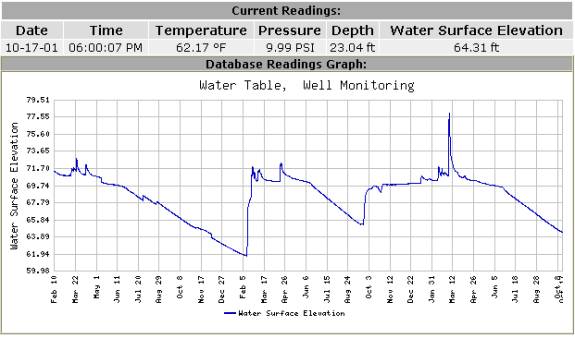
The Remtrol Solution can provide scientific information to manage water resources. It can be used to effectively assess surface and ground water resources as well as manmade storage facilities, using periodic measurements on rivers, streams and aquifers and maintain the data in a data base.
|
|

|
Real Time and Long Term MonitoringSurface and Ground water information is needed for purposes of surveillance, planning, design, hazard warning, operation, and management, in water-related fields such as water supply, hydroelectric power, flood control, irrigation, bridge and culvert design, wildlife management, pollution abatement, flood-plain management, and water resources development. To analyze this information an appropriate data base is necessary.
Data Base Analysis
|
|
Data Base AnalysisThe Solution can provide a way to collect water data sufficient to satisfy needs for current-purpose uses, such as 1) assessment of water resources, 2) operation of reservoirs or industries, 3) forecasting, 4) disposal of wastes and pollution controls, 5) discharge data to accompany water-quality measurements, 6) compact and legal requirements, and 7) research or special studies. The Solution can also collect data necessary for analytical studies to define for any location the statistical properties of, and trends in, the occurrence of water in streams, lakes, estuaries and aquifers for use in planning and design.
|
|
Planning and ManagementWater data is needed to develop information about flow and level that can be used by a variety of individuals and agencies for the planning and management of diverse water-resources projects and programs including flood warning; flood assessment; reservoir operations; monitoring water-quality and setting water-quality standards; designing infrastructure such as bridges, culverts, and dams; evaluating the effects of changing land use; detecting long-term changes in climate; and administering compacts, decrees, and treaties on bodies of water.
|
|

